The E-kalpa Team at IIT Guwahati visited the villages of Tangmang and Rangphlang in South Meghalaya to interact with craft persons of the War tribe.
The War area is located in south Meghalaya, stretching between 25º6'25"-25º18'29" N latitude and 91º57'38"-92º1’26” E longitudes (Fig 1). The mean annual temperature in this mountainous region is in the range of 23ºC and 13ºC respectively while the mean annual rainfall is 11565 mm. The steep slopes of the mountains are breathtaking, with the angle of the slope ranging between 100 and 400. We stopped intermittently to view a number of waterfalls. These would drop down to form a large number of rivers and rivulets that drain into the plains below. Our guide informed us about the various village clusters that we could see located separating one hill range from the other.
These tribal communities set aside patches of village forests that are considered sacred forests and called as Law Kyntang and Law Lyngdoh. The access to the forest produce is governed by norms set by the community and usually administered by the village headman. These forests are models of environmental sustainability and are used for religious purposes under the traditional land tenure system.

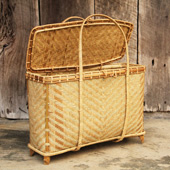
Presented here is the study of the community and documentation of the craft practices of Basket Making and Mat Making amongst the War tribe of South Meghalaya, known for the community practice of maintaining sacred forests that reflect and teach environment and nature-friendly traditions of harmoniously living with nature.


